Let's hope those ice plugs we've been babbling about this winter hold.*
From Severe Weather Europe:
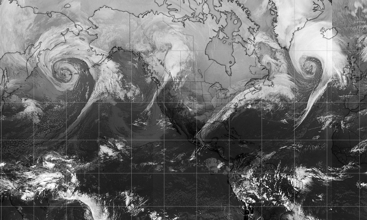
Day after tomorrow? No, but we are facing two impressive extra-tropical cyclones right now – one over the North Pacific and another over the North Atlantic
Remember the famous movie ‘The day after tomorrow’? It obviously did not get into reality, but the satellite images today across the northern hemisphere are beyond exceptional! We have first seen twins on both North Pacific and North Atlantic ocean last night, now we’re seeing two dominant extra-tropical systems! See details and comparison of both below....
*****....Feb 13th, 12 UTC analysis of both systems; the North Pacific had a central pressure of 953 mbar, the North Atlantic had a central pressure of 940 mbar! Pretty exceptional satellite presentation on both systems, where the North Atlantic is much more intense and large. Attached are sea level pressure, fronts analysis, and satellite images:
....MUCH MORE
*From the Danish Meteorological Institute the current ice thickness map. Your attention is commended to the Bering Strait top center in this view and the Svalbard Archipelago due north of Norway. The Fram Strait between Svalbard and Greenland is the main exit for ice pushed by storms coming across the top of the world and the more physical integrity the ice in the two straits can muster, the better.
