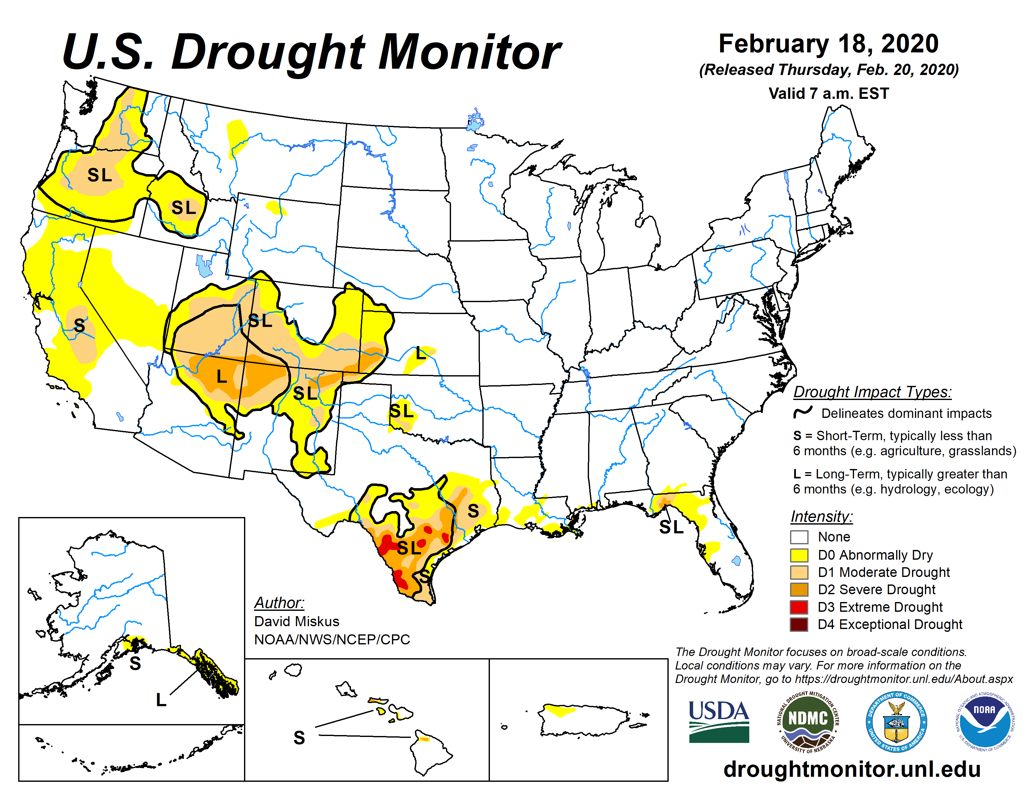
First up, from the University of Nebraska - Lincoln the most recent Drought Monitor Map:

And commentary:
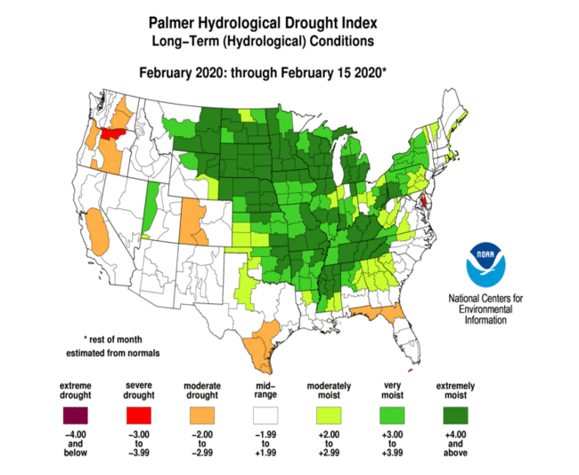
This Week's Drought SummaryFor agricultural purposes we prefer the Palmer Drought Index:
With high pressure anchored over the eastern Pacific Ocean, storm systems bypassed California, Nevada, Arizona, and Utah, instead tracking either northward into the Pacific Northwest or southward across Baja California and into the southern Rockies. Once they reached the Nation’s mid-section, ample Gulf moisture was incorporated into the storm systems, generating widespread showers and thunderstorms in the South and Southeast, along with mixed or frozen precipitation in more northern locales....MUCH MORE
