Our standard boilerplate on measuring sea ice: despite this good news, extent is not as important as thickness, and in that dimension there are still problems this season. More after the jump.
From Severe Weather Europe, February 12:
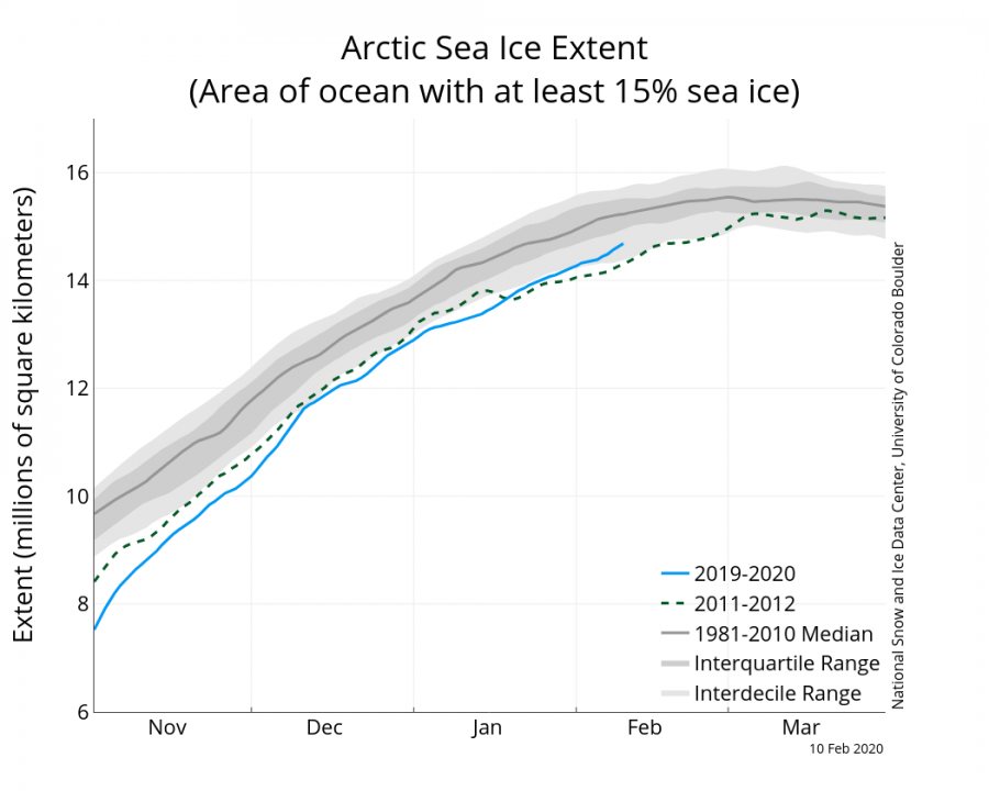
*Rapid ICE growth* Arctic sea ice reaches the largest early February ice area in the past 11 years! It even exceeds the 2001-2010 average size
Overall, winter was rather mild across much of
Eurasia and North America, with the exception of Alaska and parts of
Canada. But, that means that a lot of cold air has stayed in the polar
circle, helping to freeze more of the Arctic ocean and the surrounding
areas.
The latest sea ice analysis shows that during this rather mild winter in the mid-latitudes, the trapping of the colder air in the polar circle was beneficial to the growth and recovery of the polar icecap. Every winter the Arctic ocean freezes, reaching a maximum sea ice extent around March. below is the graphic from NSIDC, showing the ice growth progress and a comparison with 2012, which had the lowest sea ice extent on record in September. We can see that the freezing season began at rather low levels, lower than 2012, but the stronger than normal polar vortex has helped to keep more cold air in the polar regions, promoting ice growth. The second graphic is a temperature anomaly analysis for the polar circle, showing the colder than normal phases during winter, and especially currently, greatly aiding in the sea ice growth process....
*****
....The latest analysis from NSIDC shows the sea ice area and extent compared to the long term average. In most places, the extent is not far behind the long term averages. The greatest individual deficit is in the Sea of Okhotsk.

....MUCH MORE, a very detailed look at the ice.
And the problems?
First off, the ice on the western side of the Svalbard archipelago should be much thicker.
From the Norwegian Meteorological Institute:
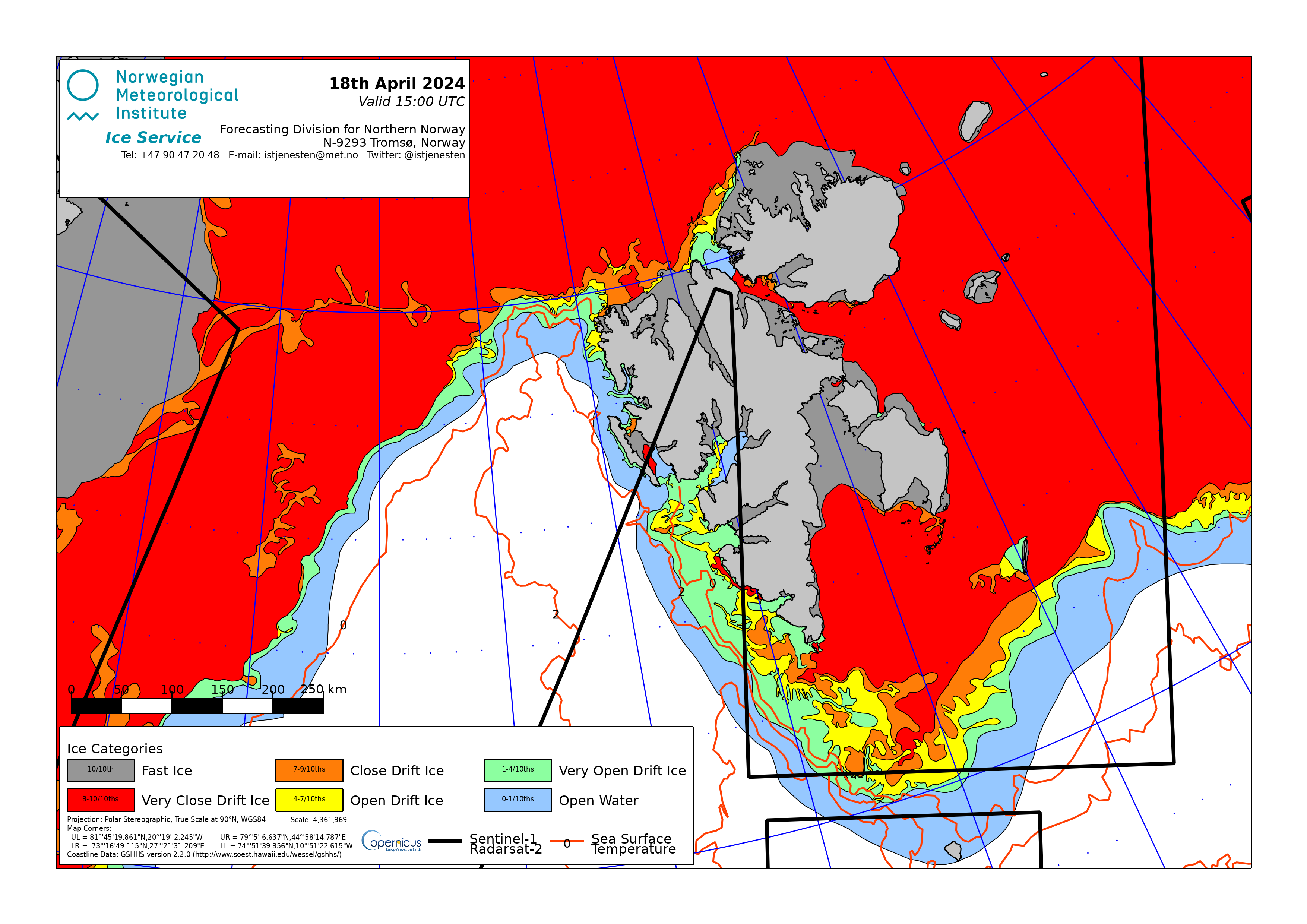
You would really like to see the dark grey and reds extending across the Fram Strait toward Greenland on the left side. The Strait is the exit into the Atlantic for ice pushed by storms coming over the top of the world and the more ice acting as a plug the better.
Secondly, you would expect thicker ice along the Russian coast (right side of map below) by this date. Although the ice will continue building through April it's the thickness that raises the odds of the ice making it to next season and becoming sweet, sweet multi-year ice.
From the Danish Meteorological Institute: 

And it's that lack of thickness that leads to the lower overall volume, despite the extent.
One final positive, the other Strait of interest, the Bering - top center in this view is doing better on both extent and thickness than it has in at least three years.
Previously in this northern saga:
Feb. 2
Jan. 7
Nov. 7