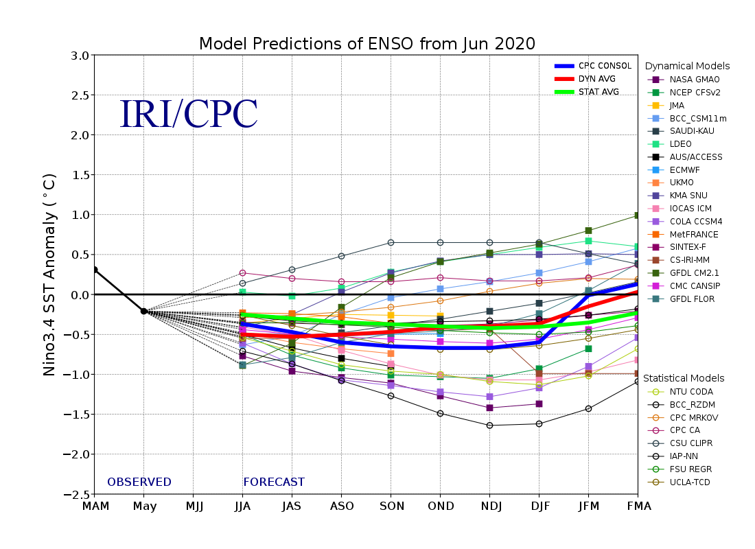
First up, from IRI/Columbia, the current plume of the model runs:
Our boilerplate definitions:
La Niña conditions exist when water temperatures off the western bulge of South America are 0.5°C lower than average. A full blown La Niña is three consecutive rolling three month periods (i.e. five months) of -0.5°C (or lower) temperature anomalies in the Niño 3.4 zone. Here's the La Niña of 2007:

And the trouble? Because we focus on the money, it is the effect of the ENSO of hurricane formation.
La Niña tends to encourage tropical storms by reducing wind shear in the Atlantic, allowing storms to get organized.
This season to date we've had that very dusty Saharan Air Layer that comes off western Africa and suppresses formation but into September, the peak of the Atlantic hurricane season, conditions will be favorable for storms.
On the other hand South Africa might get some rain which is probably a good thing.
If interested here is NOAA's La Niña effects page, they cram a lot of informtion into the discussion.