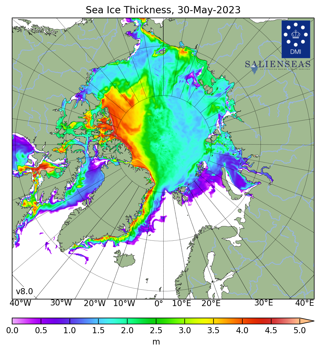
Although the ice on the Canadian side of the basin is thicker than it has been in recent years, the two chokepoints; the Bering Sea/Strait, Chukchi and Beaufort Seas at the top of the map and the Fram Strait between Greenland and Svalbard did not develop very thick ice this winter:

Danish Meteorological Institute
This is a problem because storms come across the Pole from the Bering Sea and flush the ice cap through the Fram Strait and into the open ocean. If the plugs aren't in place in both locations the probability of the ice breaking up due to mechanical (wave) action increases, exposing more dark water to the suns rays, melting more ice due to the loss of albedo and setting in motion a sort of doom-loop.
With that ice not making it through the summer there is less (and thinner) multi-year ice, which is what develops into those four and five meter-thick areas.
TL;dr: no good..
The only hope now is that the summer storms aren't too rambunctious and leave a base layer for the multi-year ice to grow on.
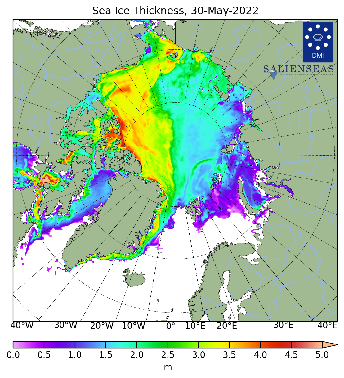
Here's last year's map for the same date, May 30. You can see the Bering Strait plug is much thicker which is, in part, why the ice on the Canadian side is so much thicker this year.

I blame, only half in jest, the Russian ice-breakers moving back and forth along the Northern Sea Route on the Russian Side of the Arctic basin and around the tip of Siberia to send stuff to Japan and China.