When the desert is in drought I remonstrate Phoenix and Las Vegas for having allowed population growth far beyond the dry times carrying capacity. When California is in drought I trot out the little chart that shows the historical prevalence of drought—last seen in April 19's "US West prepares for possible 1st water shortage declaration":
Some of the Western megadroughts have been hundreds of years long. As the San Jose Mercury-News depicted it in 2015:

—San Jose Mercury-News "California drought: Past dry periods have lasted more than 200 years, scientists say"
That little red blip at the far right side of the timeline is the current drought.
You could make a reasonable argument that for the last 150 years Californians have been living in a fool's paradise.
But when the drought spreads to North Dakota and threatens the world's best pasta wheat, durum, of which 80% of the U.S. crop is grown in the state, Well if you can imagine the Great Bucatini Shortage of 2020 spreading to all 600 types and shapes, you know my anxiety.
First up the current map, from the University of Nebraska - Lincoln, followed by the map from eight weeks (rather than our usual four) prior:

And March 2, 2021:
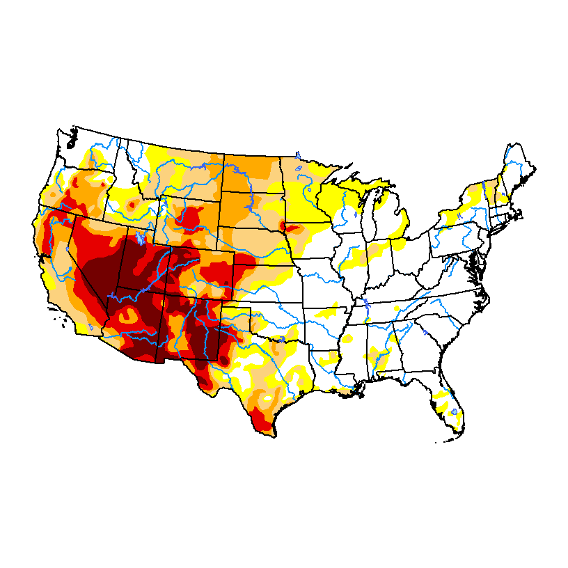
The drought summary diagnostic discussion for the area:
There were patches of 0.5-1.0 inch of precipitation in southeast Kansas, the Dakotas, Wyoming, Colorado, and the western half of Montana this week. But most of the region was dry, with less than 0.25 inch of precipitation falling. With improving conditions in the short-term (last 1-6 months), D0-D2 were pulled back in parts of South Dakota and northeastern Wyoming. But D4 expanded in northwest Colorado, and D3 expanded in eastern North Dakota where this week was dry and 6-9-month SPI are D3-D4, deeper soils are bone dry, streams are low, and stock ponds are dry or almost empty....
....MUCH MORE (all areas and national)