"The map is not the territory"
-Alfred Korzybski
"A Non-Aristotelian System and its Necessity for Rigour in Mathematics and Physics" presented before the American Mathematical Society December 28, 1931
"All models are wrong, but some are useful"
-George E.P. Box
Section heading, page 2 of Box's paper, "Robustness in the Strategy of Scientific Model Building" (May 1979)
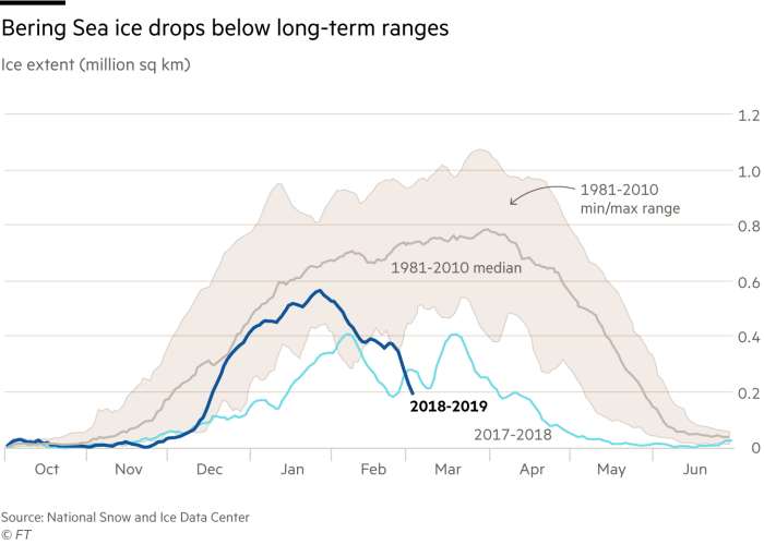
So now that we are all on the same page: models are not reality but they can point us in that direction, I've been babbling about the problem of the hotspot in the Bering Sea, Bering Strait and Chuckchi Sea. Here's March 12's "In the Middle of Winter, Bering Strait Sea Ice Is Disappearing"
Since we first mentioned the Bering/Chukchi anomaly on Feb. 28 (top center in this view):

Forbes chimed in with "Where Is The Ice That Should Be In The Bering Strait Right Now" on March 6 while the Financial Times' March 9 article "Winter ice hits record low in Bering Sea" was chock full of charts and maps including:
Notable Sea Surface Temperature Anomalies Through September 5th 2019
....In the Pacific at the equator (off South America's bulge) conditions have definitely flipped to cooler Neutral/La Niña conditions (not yet a full-blown La Niña). In the Bering and Chukchi Seas the extremely warm (4 ° - 5 ° C above average) water looks set to return for a third consecutive winter. A new feature is a warm blob off Washington and Oregon, about which NOAA issued a press release a few days ago.....And the good news?
....It is the Bering Sea hotspot that is most troubling as a failure to build ice there allows polar storms to run all the way across the Arctic and push ice out through the Fram Strait between Greenland and Svalbard, adding a huge mechanical factor to straight-up melting of the Arctic ice.....
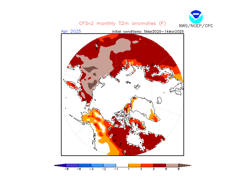
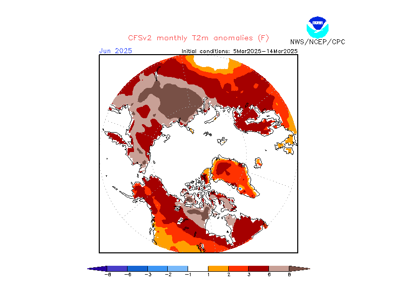
The latest model runs of NOAA's Climate Forecast System CFSv2, a coupled air, sea, land, ice model (meaning they attempt to model the interactions) has the air temperature heat dissipating for the first time in three years.
note—this is air temp., T2m, measured at two meters, not sea surface temperature which is much slower to respond but it is a step in the right direction.
Anomaly forecast for October 2019, The Bering Strait is on the left, the top hot spot is over the East Siberian Sea, the lower one is the Beaufort sea.
From NOAA's Climate Prediction Center:
Jumping ahead to December the hotspots are beginning to dissipate and the air off Greenland's east coast is also cooling, in this case to a lower than average temperature facilitating sea ice growth in the Fram Strait which acts like a stopper in a bottle:
And by February 2020 the modeled air temperatures have dropped considerably below average across the Arctic:
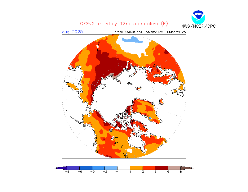
Here's the entire series through March 2020, you can click on the individual maps to enlarge:
CFSv2 forecast monthly T2m anomalies