For example, the state of Texas has been essentially drought-free since May while the map is just now catching up:

NOTE: To view regional drought conditions, click on map above. State maps can be accessed from regional maps.
As El Nino continues to strengthen, the probabilities favor a dramatic and rapid change in California hydrology that the 'Monitor' map won't capture.
As another example, here's what the Drought Monitor commentary was for "The West" in the week ending July 21, 2015:
During the past week, average temperatures were below normal across much of the West with the exception of western portions of California and Oregon, eastern New Mexico, and Washington. During the weekend and into Monday, moisture associated with Hurricane Dolores triggered showers and thunderstorms across parts of southern California and western Arizona. Some locally heavy accumulations (two-to-four inches) and flash flooding were reported. Despite well-above-average precipitation during the past 90-days in parts of central and southern California, the Sierras, and portions of the Great Basin, the recent rains have not impacted the overall drought situation in these areas because significant precipitation deficits remain as well as agricultural and hydrological (low reservoirs, below normal streamflows) impacts. In the Pacific Northwest, precipitation has been below normal since the beginning of the Water-Year (Oct. 1). The trend has continued during the past 60-days leading to very low streamflows, dry soils, and increasing concern in the agricultural sector. In the Southwest, some improvements were made on this week’s map in areas of Severe Drought (D2) in west-central New Mexico as well as east-central and northern Arizona where long- and short-term drought indicators (precipitation, soil moisture, streamflows, and vegetative health) have shown improvement during the past year. However, according to the Natural Resource Conservation Service (NRCS), statewide reservoir storage remains below normal in both Arizona and New Mexico. According to the Salt River Project (SPR), the Salt River system reservoirs are currently 53% full while the Verde River system reservoirs are 52% full. In New Mexico, Elephant Butte (the state’s largest reservoir on the Rio Grande) is currently 27% of average – up 9% from the same time last year. Elsewhere, statewide reservoir storage is above average in Colorado, Idaho, Montana, and Wyoming.You just don't get that from the map.
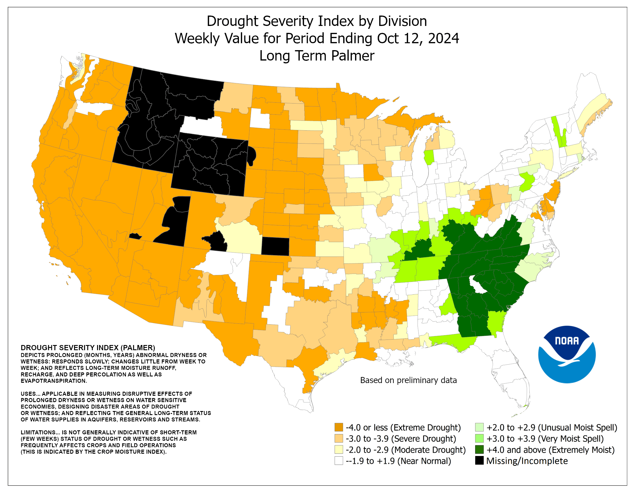
So in addition to the University of Nebraska-Lincoln map we will be adding the Palmer Drought Severity Index map from NOAA's Climate Prediction Center via the U.S. Drought Portal:

The Palmer has its own short term issues but between the two of them we'll get closer to reality.
We'll have more as California gets nearer to mud season.