From Deutsche-Welle, October 7:
Water levels on the river typically drop later in fall with knock-on effects for trade and industry. A government plan to deepen the crucial waterway to curb future disruptions is proving controversial.
It's difficult to overstate just how important the Rhine river is for the countries it flows through.
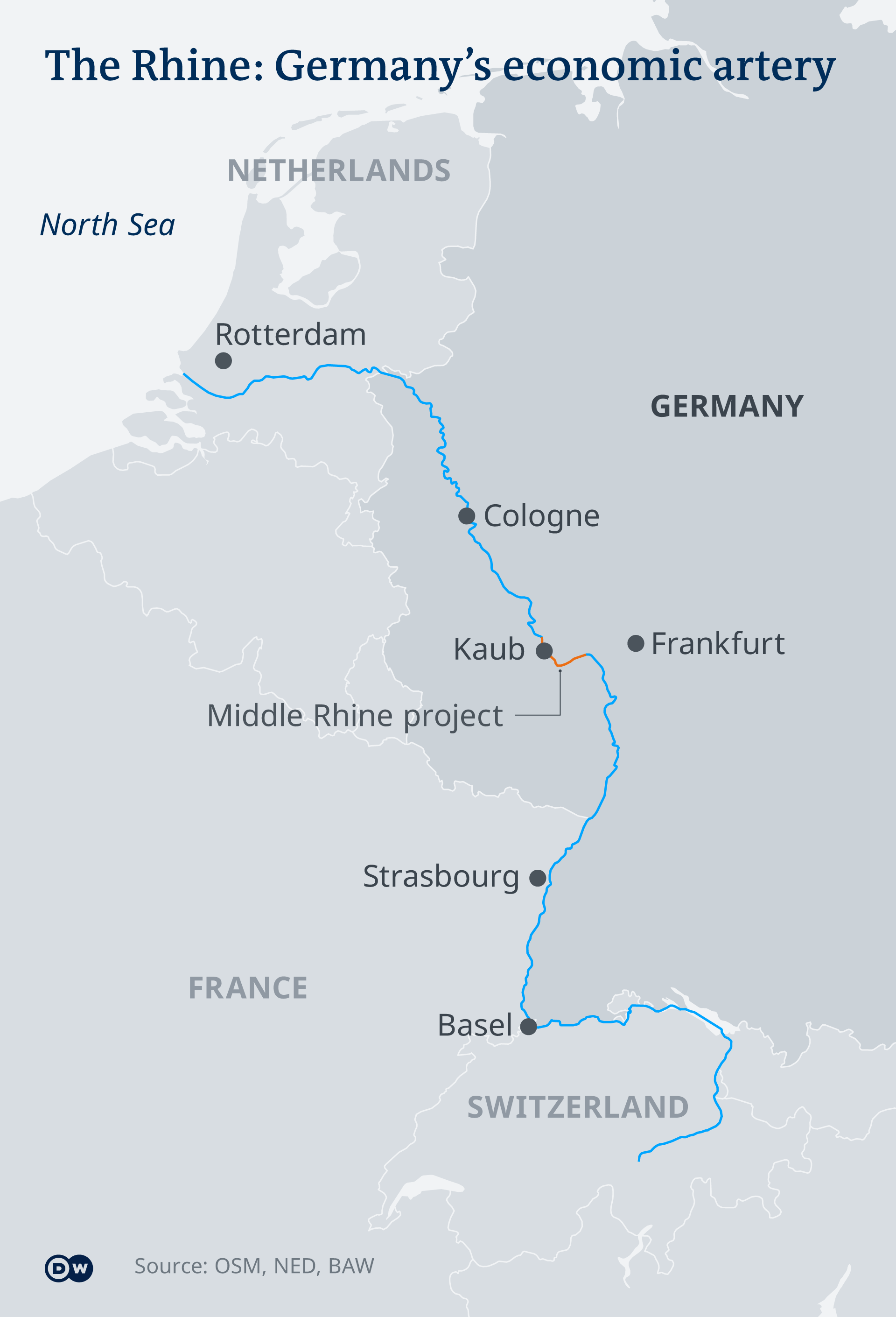
This mighty waterway serves as an economic lifeline in western Europe, connecting industry in Germany, France and Switzerland with the port of Rotterdam in the Netherlands.
Each year, more than 300 million tons of cargo are shipped along its length, from chemicals to coal, grain to car parts. Major companies have riverside plants that rely on these shipments. And when navigation is disrupted by low water levels — as was the case during this year's drier-than-average summer — the costs can be huge.
It's a scenario the German government is keen to avoid.
As part of an action plan to protect shipping, it's boosting the number of vessels adapted to low water. More controversially, it also wants to deepen a section of the Middle Rhine Valley — a proposal that has been welcomed by businesses but viewed with skepticism by environmentalists and some locals.
What is the project about?
The focus is a 50-kilometer (31-mile) section of the World Heritage-listed Middle Rhine — where the river is flanked by craggy cliffs, hilltop castles and wine-producing villages.

The shipping channel in this part of the Rhine is shallower at certain bottlenecks. That means vessels coming from the North Sea, for example, need to carry less cargo during times of low water to be able to pass through safely on the way to Germany's industrial southwest.
"When in doubt, it has to load much less," said Sabine Kramer from the Rhine Waterways and Shipping Administration (WSA) and the area manager for the project.
The government's plan envisages deepening the navigation channel by 20 centimeters (about 8 inches) — from 1.9 meters at low water to 2.1 meters — to bring this potentially tricky stretch in line with areas further upstream and downstream....
....MUCH MORE
Tough decisions have to be made.