First up, the October 15 press release but if interested take a look at the maps linked in the experimental product, last year we found them to be accurate enough to guide speculations.
From the National Oceanic and Atmospheric Administration:
U.S. Winter Outlook: Cooler North, warmer South with ongoing La Nina
Persistent drought dominates the Western landscape
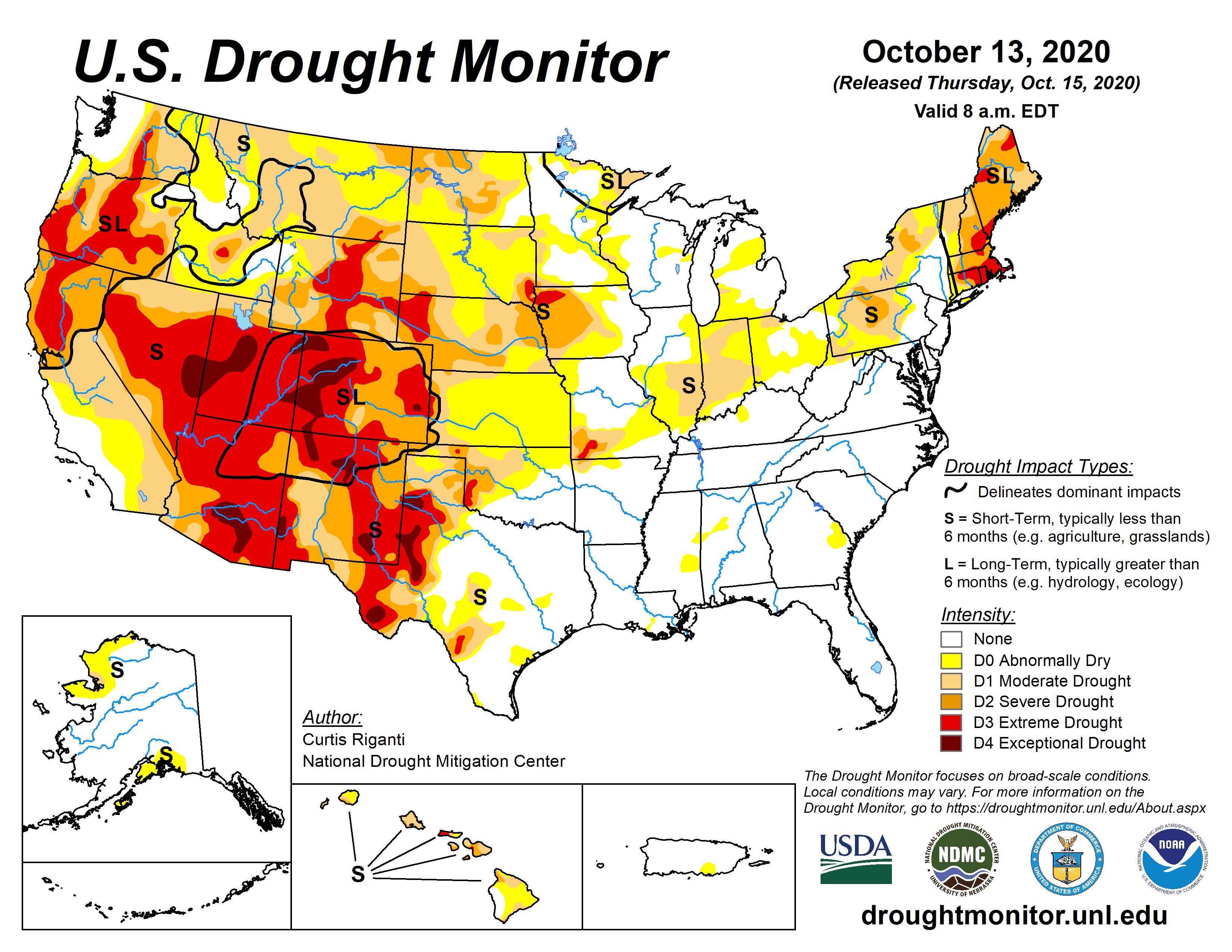
NOAA’s winter forecast for the U.S. favors warmer, drier conditions across the southern tier of the U.S., and cooler, wetter conditions in the North, thanks in part to an ongoing La Nina. Forecasters at NOAA’s Climate Prediction Center — a division of the National Weather Service — are also closely monitoring persistent drought during the winter months ahead, with more than 45% of the continental U.S. now experiencing drought....
.... “With La Nina well established and expected to persist through the upcoming 2020 winter season, we anticipate the typical, cooler, wetter North, and warmer, drier South, as the most likely outcome of winter weather that the U.S. will experience this year,” said Mike Halpert, deputy director of NOAA’s Climate Prediction Center.
This U.S. Winter Outlook 2020-2021 map for temperature shows above-average temperatures are likely in the South and below-average temperatures likely in parts of the North. (NOAA Climate.gov, using NWS CPC data)
This 2020-2021 U.S. Winter Outlook map for precipitation shows wetter-than-average weather is most likely across the Northern Tier of the U.S. and drier-than-average weather is favored across the South. (NOAA Climate.gov, using NWS CPC data)
...MORE
And the Experimental Unofficial Long-Lead Forecasts : Two-Class Probabilities
Here's the current U.S. Drought Monitor map from the University of Nebraska-Lincoln, new map tomorrow:
