From Unisys the Sea Surface Temperature anomaly map:

The extreme anomaly we saw along the US eastern seaboard in May has dissipated a bit but is still running above the 30-year average.
Meaning storms that get to, say South Carolina, will have fuel to intensify.
Probably more interesting is the west coast of South America at the equator and extending out to the Dateline: that damn near looks to be a budding La Niña.
Anyhoo, on to the headline story, From the risk transfer intelligence mavens at Artemis:
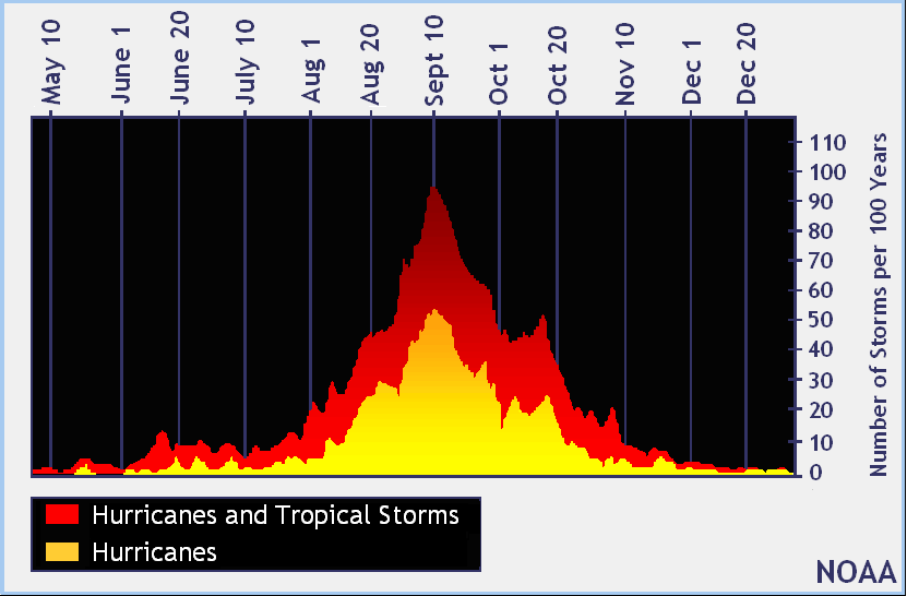
The tropical Atlantic is forecast to see activity levels of greater than 130% above average over the next two weeks, according to forecasters from the Colorado State University. The CSU team highlight a number of possible tropical storm or hurricane threats as we approach the peak of the 2017 Atlantic hurricane season.
Activity is measured based on accumulated cyclone energy (ACE) of named tropical storms and the CSU forecasters, led by Philip Klotzbach, believe that ACE will run at least 130% above the norm over the coming fortnight.
First, tropical storm Harvey has formed and is now threatening the Leeward Islands of the Caribbean, before it tracks into the deeper Caribbean and takes aim on Central America. Harvey is currently not forecast to reach hurricane strength, but with waters warm and the possibility of a shift into the Gulf, the chances of intensification cannot be completely discounted.
Second, the National Hurricane Centre (NHC) and other forecasters are predicting that tropical waves in the Atlantic have a reasonable chance of development, one a high chance the other medium.
The tropical wave with a high 70% chance of development is forecast to take a path along the top of the Caribbean towards the Bahamas, which puts its current forecasted path dangerously close to Florida. At this stage it is too early to forecast potential strength, or even whether this will become tropical storm Irma, but this is definitely a disturbance to watch for insurance and reinsurance interests.Finally from Ryan Maue, Weatherbell meteorologist and keeper of the Accumulated Cyclone Energy stats:
The medium chance disturbance is expected to curve further north, if it can become a named storm....MORE
Cape Verde hurricane in the ensemble prognostications ... Harvey in Gulf and 92L re-curves off East Coast. Possibilities next 10-days: pic.twitter.com/ISQljiiYV1— Ryan Maue (@RyanMaue) August 22, 2017